I was trudging around some thickets the other day putting my new Carhart's to the test (love 'em, I move through briar patches like butter) and was looking for some bunny habitat. I was kicking around brush piles, looking for a floating dark marble, or maybe even a nice fat unsuspecting grouse as I stopped intermittently and zigzagged through the dormant vegetation. Some pellets or tiny trails would've been exciting. There was a little snow, but not a lot a hardship has hit the animals, so I didn't expect to see any chewed up twigs just yet.
As I moved through the place, the mind began to wander and the hamster wheel started turning. What if I could save time and scout from home a bit like I do with the deer? I never found aerials too good for hunting big woods, because the habitat all looks the same from the air. I did however think about topo. Now, although many of these cartographers completed their work in the Adirondacks around the 1960s and 70s, many of the marshy areas documented remain. I've never been a huge fan of swamps, but maybe some thick cedars or something surrounding would give me an end to search further....
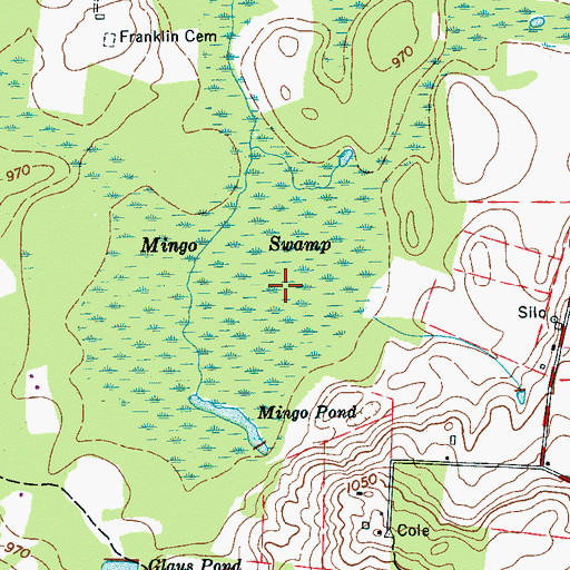
So with something like this, I would simply skirt the actual swamp labeled on the map, looking for the thick cedars or tag alder thickets. If I came across some young spruce, balsam, or fir on the way through the hardwoods to the swamp, great, but I find that
YOUNGsoftwood pockets are too tough to identify without actually being there. Anyone have any success with maps for bunnies in particular?


